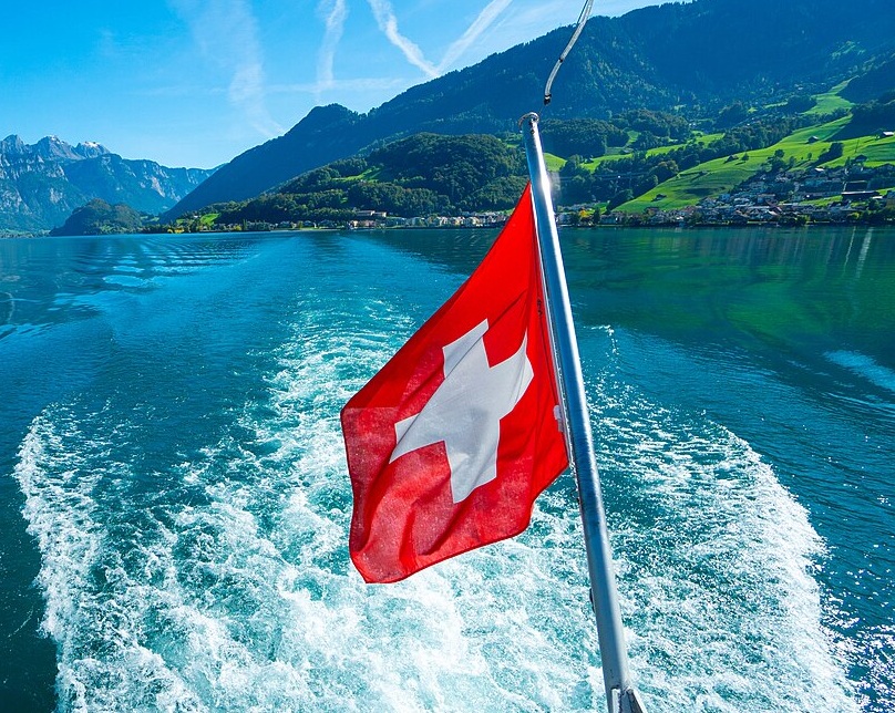
Switzerland: 10 Hidden Gems You Need to Discover
Beyond the famous Alps and chocolate, discover Zurich's Grossmünster, Lake Brienz, the Brienzer Rothorn, Brienz/Brinzauls, the Aare Gorge, Gelmersee, Val Russein, Leuk Castle, the Belvédère Hotel on the Furka Pass, and Bannalpsee—a peaceful reservoir in Nidwalden with mirror-like reflections and easy cable-car access.
When travelers think of Switzerland, the Alps, chocolate, and Lake Geneva often come to mind. But in the heart of Zurich, on the banks of the Limmat, stands a church that changed the course of European history. The Grossmünster is not just another cathedral—it is the birthplace of the Swiss-German Reformation and one of Zurich's most recognizable landmarks. If you're looking for a hidden gem that combines centuries of history, stunning views, and contemporary art, start here.
Grossmünster
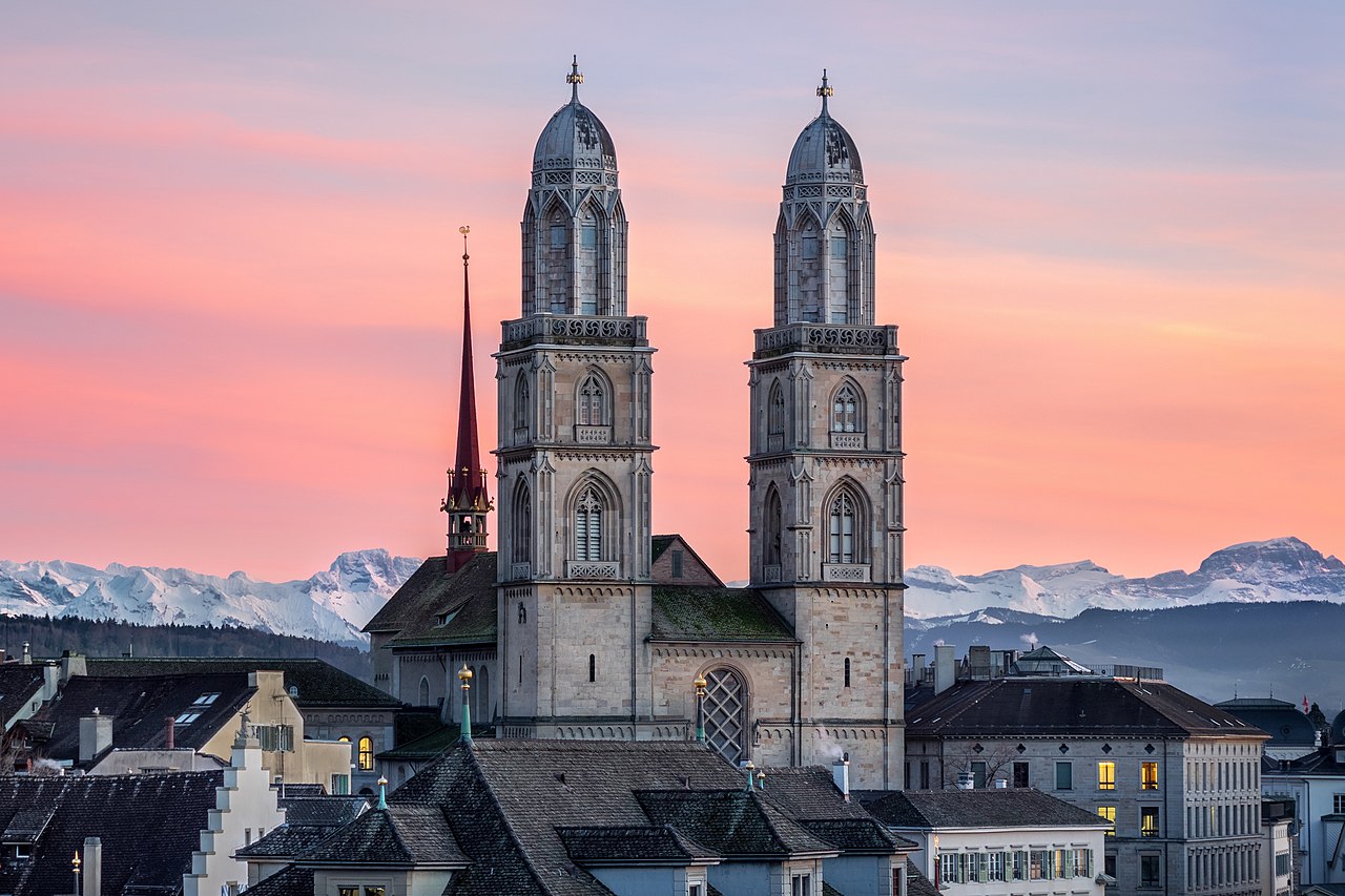
The Grossmünster ("great minster") is a Romanesque-style Protestant church in Zurich, Switzerland, and one of the city's four major churches, along with the Fraumünster, Predigerkirche, and St. Peterskirche. According to legend, Charlemagne's horse fell to its knees over the tombs of Felix, Regula, and Exuperantius—Zurich's patron saints—and the emperor commissioned the church on that spot. Construction of the present building began around 1100 and it was inaugurated around 1220. The church was built with Bollinger Sandstein, and its twin towers, erected between 1487 and 1492, are regarded as perhaps the most recognized landmark in Zurich. (The original wooden steeples were destroyed by fire in 1763; the present neo-Gothic tops were completed in 1787—Richard Wagner is said to have mocked them as "two pepper dispensers.") What makes the Grossmünster truly special is its role in history: Huldrych Zwingli initiated the Swiss-German Reformation from his pastoral office here starting in 1520, and in 1523 he won a series of debates that led local authorities to sever the church from the papacy. The reforms left the interior plain: the iconoclasts removed the organ and religious statuary in 1524, and today the church houses a Reformation museum in the cloister.
The Grossmünster stands near the banks of the Limmat in the historic center of Zurich, in the Canton of Zurich. Zurich Hauptbahnhof (HB) is the main railway station and the largest in Switzerland; from there it is a short walk or tram ride to the church. The entrance to the Karlsturm (Charlemagne Tower), one of the two towers, is in the middle of the nave. The tower climb costs 4 CHF for adults. There is no elevator—you must climb 187 steps—but at the top you'll find four viewing terraces with breathtaking panoramic views over Zurich, the Limmat, and the Alps. Visitors often find surprisingly few people at the top, so you can take your time to enjoy the view.
Inside, don't miss the Romanesque crypt, which dates to the 11th and 13th centuries and holds a statue of Charlemagne. The church also features modern stained glass: Augusto Giacometti's windows were added in 1932, and between 2006 and 2009 the German artist Sigmar Polke completed a set of stained glass windows that have become a highlight. According to sources from the visit, Polke used agate stone slices—a technique used in window-making since the Middle Ages—and the windows carry religious themes such as the Scapegoat (with tourmaline representing wounds) and the Prophet Elijah. The bronze doors by Otto Münch (1935 and 1950) at the north and south portals depict Zwingli and Charlemagne. The annex to the cloister houses the theological faculty of the University of Zurich (the Carolinum), built by Gustav Albert Wegmann in 1843. Grossmünster and the Carolinum are listed as Class A objects of national importance in Switzerland.
After the climb, head to Café Henrici at Niederdorfstrasse 1 for what has been called Zurich's best coffee, or try the tarte flambée (from 18.50 CHF) and homemade unsweetened iced tea. The Grossmünster is open to visitors; check grossmuenster.ch for current opening hours and any restrictions. Whether you come for the Reformation history, the tower views, or Polke's luminous agate windows, the Grossmünster is a hidden gem that rewards every traveler who steps inside.
Lake Brienz
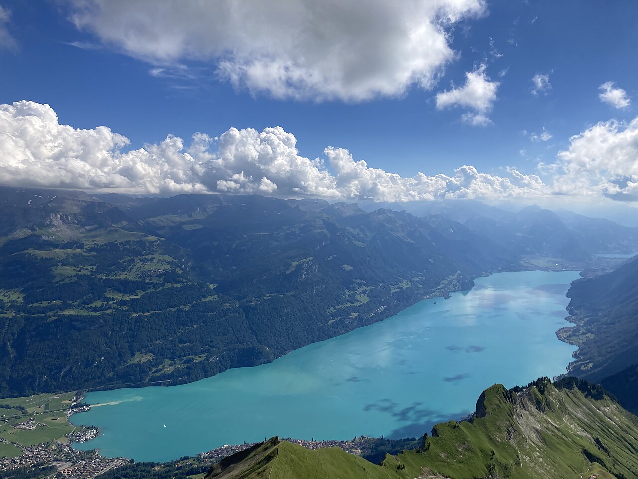
Lake Brienz (Brienzersee) is a lake just north of the Alps in the canton of Bern, Switzerland. It stretches about 14 kilometres (8.7 mi) long and 2.8 kilometres (1.7 mi) wide, with a maximum depth of 260 metres (850 ft) and a surface 564 metres (1,850 ft) above sea level. Fed by the upper Aare at its eastern end, the Giessbach stream from the southern shore, and both headwaters of the Lütschine (from Grindelwald and the Lauterbrunnen Valley), the lake drains into the Aare at its western end. The village of Brienz, from which the lake takes its name, lies on the northern shore at the eastern end. In the west, the Bödeli separates Lake Brienz from neighbouring Lake Thun; Bönigen sits on the lake frontage of the Bödeli, while Interlaken lies on the Aare between the two lakes. Iseltwald is on the south shore; Ringgenberg, Niederried, and Oberried are on the north shore. The lake has a dramatic, fjord-like character—narrower and smaller than Lake Thun—with the high mountains of the Bernese Oberland towering over turquoise waters.
Passenger ships have operated on the lake since 1839. BLS AG runs five ships that link Interlaken Ost railway station (reached via a 1.3 km navigable stretch of the Aare) with Brienz and other lakeside settlements, and connect to the Giessbachbahn funicular for the Giessbach Falls. From late May to mid-September, a scheduled boat departs Brienz at 10:40 a.m. toward Interlaken Ost; you can enjoy a "Captain's Breakfast" on board (croissant, Ruchbrot, butter, jam, ham and cheese, orange juice, and a hot drink for about 19 CHF, excluding the boat ticket; Brienz to Interlaken Ost is about 32 CHF in 2nd class without a half-fare card) on the roughly 70-minute crossing. The breakfast boat runs daily on Lake Brienz until 23 October. The Brünig railway line follows the northern shore; the A8 motorway runs in tunnels above the southern shore.
The town of Brienz is the perfect base for a morning or afternoon. The lakeside promenade is wide and flat, lined with trees and benches, with free deck chairs along the shore. Families love the water play area with pumps and a maze; there are also swimming steps (the water is chilly but refreshing), and you can rent kayaks or paddleboards (e.g. Pirate Bay Nautical Centre or Hightide Kayak School near Interlaken). The Brienz Rothorn Bahn, Switzerland's oldest steam cogwheel railway, climbs to the Brienzer Rothorn with stunning views of the Bernese Alps (return about 96 CHF per adult, 10 CHF per child; book in advance). About 15 minutes by car from Brienz, the Aare Gorge (Aareschlucht) offers a wooden walkway through a narrow gorge with waterfalls (about 12 CHF adult, 6 CHF child). Whether you come for a boat trip, a stroll along the promenade, or the steam railway, Lake Brienz is a hidden gem that rewards every traveler who explores its shores.
Brienzer Rothorn
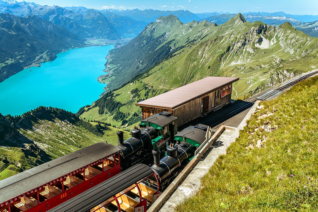
The Brienzer Rothorn (Red Horn of Brienz) is a mountain of the Emmental Alps in Switzerland and the highest summit of the range, at 2,350 metres (7,710 ft) above sea level. To its west lies the Tannhorn; to its east are Arnihaaggen, Höch Gumme, and the Brünig Pass (1,008 m). On its south side it overlooks Lake Brienz; to the north it looks out over the Waldemme valley. The summit is shared by the municipalities of Brienz and Schwanden bei Brienz (canton of Bern), Giswil (Obwalden), and Flühli (Lucerne)—and it is the highest point in the canton of Lucerne. What makes the Brienzer Rothorn truly special is how you reach it: the Brienz Rothorn Bahn is the only rack railway in Switzerland that still runs on steam, in operation since 1892.
The steam train departs from Brienz and climbs to the summit station at 2,244 metres (7,362 ft) on the Bernese side. Arrive early in Brienz to buy tickets at the cash desk and choose your seat; if you turn up shortly before departure, seats fill up and you may be separated from your group. For the best view when driving up, take a seat by the gate on the lake side. The ride takes about 100 minutes at a top speed of 9 km/h—steam, stomping, and spectacular mountain scenery all the way. The Swiss Half-Fare card is accepted; Reka cheques are credited at 50%; on your birthday your ride is free; and per paying adult, two children up to 15 years travel free. Check brienz-rothorn-bahn.ch for timetables and prices. You can also reach the summit from Sörenberg (Flühli) by cable car.
Once at the top, the view of Lake Brienz and the Bernese Alps is overwhelming. The Berghaus Alpine Lodge at the summit has a terrace where you can enjoy a Rösti (a typical Swiss dish of grated, crispy roasted potatoes) while taking in the panorama—one of the best ways to extend your stay before the return journey. Hikers can continue from the Rothorn along various routes; the Panorama trail links to Schönbüel, and experienced walkers can tackle the ridge over Höch Gumme and Arnihaaggen (allow around 4–5 hours, T3 grading). It can be surprisingly chilly at the summit even in summer, so bring a layer. Whether you come for the steam railway, the views over Lake Brienz and Interlaken, or a high-Alpine walk, the Brienzer Rothorn is a hidden gem that rewards every traveler who makes the climb.
Brienz/Brinzauls
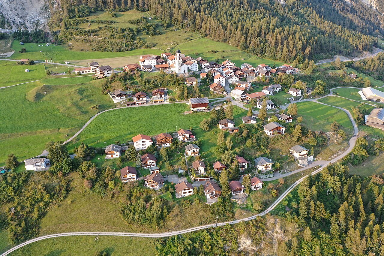
Brienz/Brinzauls (Romansh: Brinzauls) is a village in the canton of Graubünden (Grisons), Switzerland—not to be confused with Brienz on Lake Brienz in the Bernese Oberland. It sits on a natural sun terrace at about 1,144 metres (3,753 ft) on the road between Lenzerheide and Davos, north of the Albula River. On 1 January 2015, the former municipality merged with Alvaschein, Mon, Stierva, Tiefencastel, Alvaneu, and Surava to form the new municipality of Albula/Alvra. The village was first mentioned around 840 as Brienzola. By the 12th century it was an economic centre for the Bishop of Chur; the Lords of Brienz owned a fortified tower here (first mentioned 1259; the tower fell into ruin and was demolished in 1880). Until 1851 the village was part of the Herrschaft of Belfort. The village has had its German–Romansh double name since 1 January 1997; the majority of the population speaks Swiss German, with a significant Romansh-speaking minority. The village church, first mentioned in 840, has St. Calixtus as patron saint (since 1519) and became a separate parish in 1526. The Landwasserstrasse (1870–73) connected Brienz/Brinzauls to the rest of the country. Agriculture remains important; in 1990 about 43% of jobs were in agriculture.
The village is a Haufendorf—an irregular, unplanned cluster of buildings around a central area—on a terrace north of and above the Albula. The area also includes the hamlet of Vazerol on the old Julierstrasse/Septimerstrasse (Obere Strasse) near the Julier Pass. Surrounded by Alvaneu, Alvaschein, Lantsch/Lenz, Surava, and Tiefencastel, Brienz/Brinzauls is twinned with Brienz in the canton of Bern. Before the merger the municipality covered 13.37 km²; over 22% was agricultural land, about 51% forested. The municipal cultural trail and the Belfort ruins (history of the Herrschaft of Belfort) are among the local highlights. Check myswitzerland.com and the Albula/Alvra or Graubünden tourism offices for current excursions and access.
Please note: since May 2023 the village has been affected by landslide and rockfall risk from the mountain above. Evacuations took place in 2023 and again in November 2024; access to the village and its immediate surroundings may be restricted or prohibited. Before planning a visit, check current conditions with official sources (e.g. Graubünden canton, Albula/Alvra, or Switzerland Tourism). Even when access is limited, Brienz/Brinzauls remains a hidden gem of the Grisons—a small Romansh- and German-speaking village on a sunny terrace between Lenzerheide and Davos, with centuries of history and a distinctive character.
Aare Gorge
, Switzerland.jpg)
The Aare Gorge (Aareschlucht) is a section of the river Aare that carves through a limestone ridge near Meiringen, in the Bernese Oberland, Switzerland. An indirect product of glaciation—about 10,000 years ago, as the Ice Age ended, meltwater eroded a deep, narrow chasm through the limestone—the gorge is barely 2 kilometres (1 mi) long but bordered by sheer cliffs up to 50 metres (160 ft) high. The width varies from about 30 metres (98 ft) at its widest to just 1 metre (3 ft 3 in) at its narrowest. Many visitors combine it with a trip to the nearby Reichenbach Falls, which Sir Arthur Conan Doyle chose as the setting for Sherlock Holmes's confrontation with Professor Moriarty. Permission to build walking paths was granted in 1887, and the walkway has been open to the public since 1889.
The path is a wooden construction on a metal frame cantilevered out from the gorge wall, with short stretches in tunnel. You can enter from either end; an admission charge is levied at each entrance. The Meiringen–Innertkirchen railway serves both: Aareschlucht West station at the western end (near Meiringen), and the underground Aareschlucht Ost station at the eastern end, connected to the eastern entrance by a suspension bridge. From Meiringen station you can take the train for a short ride to Aareschlucht West, then walk about 10 minutes to the west entrance; or take the train to the east station and walk to the east entrance (cross the Aare and a short climb). The west entrance has a restaurant and kiosk; the east has a bistro and kiosk. As of 2025, admission is about 12 CHF for adults and 7.50 CHF for children 6–16 (under 6 free); combo tickets with Reichenbach Falls are available. The gorge is typically open from mid-April to early November; the eastern entrance often opens from May. Check aareschlucht.ch for current opening times and prices.
The glacier-fed Aare runs through in striking turquoise-blue water—especially dramatic in May when snowmelt increases the flow. The "Cathedral" section midway through has a wider opening where sunlight streams in; the narrowest stretch ("Thundering Waters") echoes with the roar of the river. It is cool and damp inside; bring a light jacket even on warm days. About half of the gorge is accessible for strollers and wheelchairs; the eastern section has more stairs. Allow 40–50 minutes for the full walk at a casual pace. In July and August, evening lighting (e.g. Friday and Saturday 18:30–22:00) illuminates the rock and water. Meiringen claims to be the birthplace of meringue—try it at local bakeries—and the Reichenbach Falls funicular, the Sherlock Holmes Museum, Lake Brienz, and the Ballenberg Open-Air Museum are all within reach. Whether you come for the geology, the turquoise water, or the thrill of walking through a 1-metre-wide chasm, the Aare Gorge is a hidden gem that rewards every traveler who steps inside.
Gelmersee
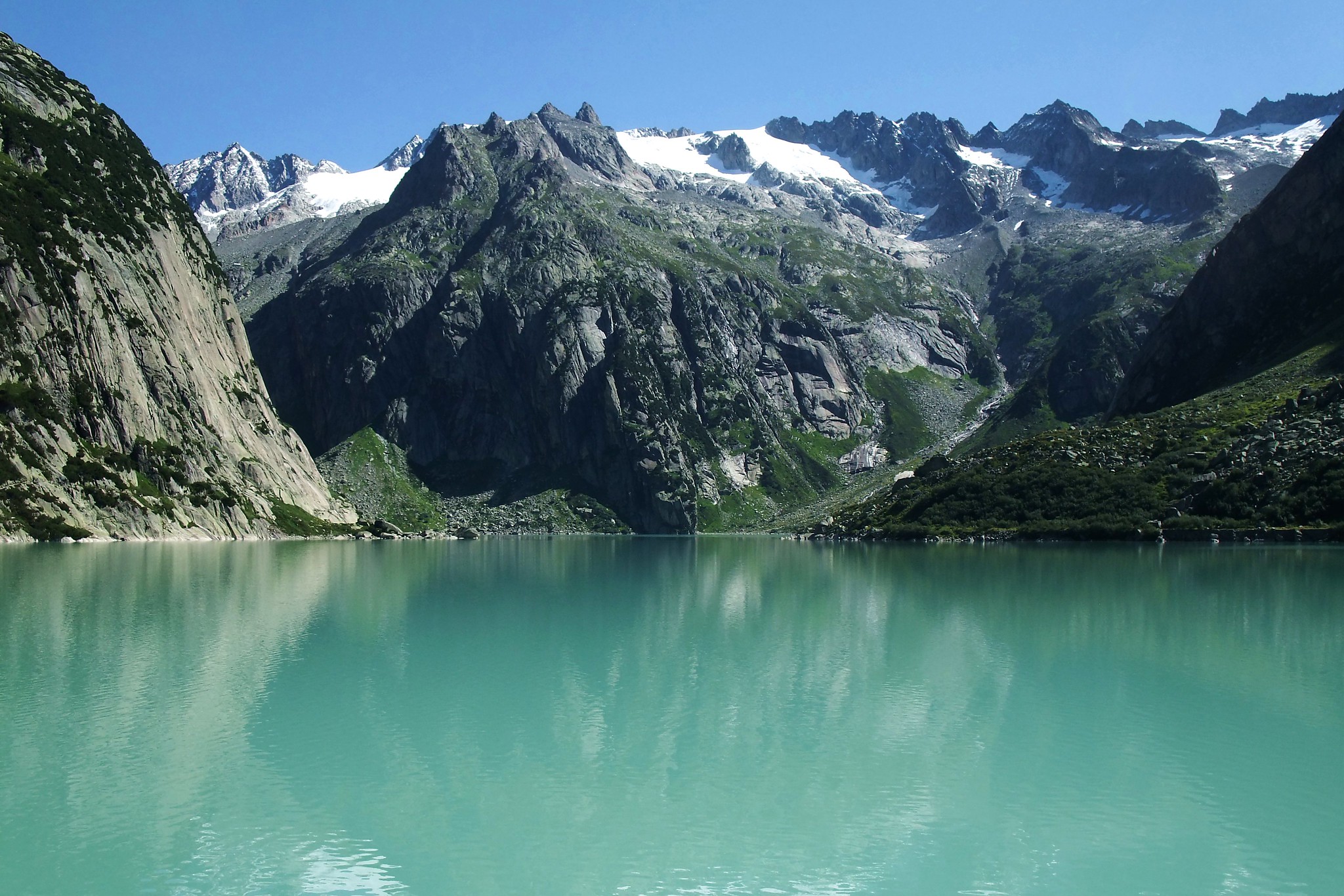
Gelmersee (Lake Gelmer) is a hydroelectric reservoir in the Bernese Oberland, Switzerland, completed in 1932 and operated by Kraftwerke Oberhasli together with the Grimselsee. The reservoir holds 13 million cubic metres of water, with a surface area of 64.5 hectares (159 acres) and a surface elevation of 1,850 metres (6,070 ft). When you reach the lake—whether by the Gelmerbahn funicular or on foot—the colour of the water is strikingly vivid blue, surrounded by rugged mountains. At the far end of the lake, two waterfalls feed it with clean alpine water. There is no restaurant or shop at the top, so bring a picnic and enjoy the scenery. It is a special destination that makes you feel like you are at the end of the world.
You can reach Gelmersee in two ways. First, the Gelmerbahn from Handegg (Guttannen) at 1,412 m—the steepest open-air funicular in Europe, with a maximum inclination of 106% and a track length of 1,028 m. The ride takes about 10 minutes one way; there is only one track, so trains run roughly every 30 minutes and capacity is limited (about 24 people per train). Book in advance at grimselwelt.ch. As of sources consulted: return about 32 CHF adults, 16 CHF single; children 6–16 return 12 CHF, single 6 CHF. The funicular is closed in winter and spring. Alternatively, you can hike up for free: from the parking at the start of the trail (free parking; coordinates near Handegg) the ascent is about 1.8 km and takes around 40 minutes at a steady pace; the path passes Stockseewli (a small lake) and has some exposed sections with chains. By public transport, take the train to Meiringen and then post bus 161 to Handegg, Kunzentännlein (hike start) or Handegg, Gelmerbahn (funicular).
Once at the lake, you can picnic by the water, dip your feet (or brave a swim in the cold water), or hike around the lake. The circular hike around Gelmersee is 4.5 km and takes about 2–3 hours; it is a T3 trail (challenging mountain path)—rough, partly secured with ropes or chains, and not suitable for young children or anyone without good balance. There are toilets near the dam (about 300 m from the upper station). Don't miss the Handeck suspension bridge (Handeckfallbrücke) spanning the Handeck Gorge behind the funicular ticket office—about 70 m above the Aare—and the Handeck waterfall. Whether you come for the steepest funicular in Europe, the free hike up, or the vivid blue lake surrounded by mountains and waterfalls, Gelmersee is a hidden gem that rewards every traveler who makes the journey.
Val Russein
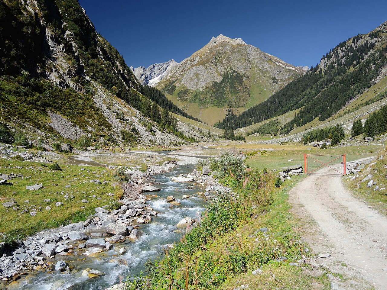
Val Russein is a valley of the Swiss Alps in Graubünden (Grisons), south of the Tödi Group. It is drained by the Aua da Russein, a tributary of the Vorderrhein, near Cumpadials (962 m), and belongs to the municipalities of Disentis and Sumvitg. Three side valleys converge at Alp Cavrein (1,575 m) to form the main Val Russein: Val Cavadiras, Val Gronda da Cavrein, and Val Gronda da Russein. The valley is approximately 10 kilometres long and includes some of the highest mountains in the canton outside the Bernina Range—the Tödi (also Piz Russein) at 3,614 m, Piz Urlaun (3,359 m), Düssi (3,256 m), and Piz Cambrialas (3,208 m). The valley is connected to the canton of Uri by the Fuorcla Cavadiras (2,609 m) and to Glarus by the Sandpass (2,781 m). A small hydroelectric dam sits at Barcuns Dadens (1,362 m); at the bottom of the valley the river is crossed by a road bridge and a rail viaduct.
There is not much in the valley other than very beautiful, very quiet scenery: the dam and a few holiday homes at Barcuns Dadens near the start, then a gravel road and a few farmhouses. Past the dam the valley opens into meadows. Many visitors head up Val Cavadiras to the Camona da Cavardiras hut for the night and then down to Maderanertal the next day. Hikers and mountain bikers follow the road to Alp Russein (about 1,770 m at the head of the valley)—an isolated corner of the Alps with meadows, cows, and marmots. The MTB Route 208 "Val Russein" runs from Disentis via Sumvitg to Alp Russein and back (about 32 km, +/− 1,285 m; full Graubünden tour options are longer). The climb to Alp Russein is steep in places; the last stretch can be rough. A grand circular tour (about 47 km, 5 hours, 2,200 m ascent) from Disentis crosses the impressive Punt Gronda (mid-19th century bridge built from 450 tree trunks), climbs into Val Russein past the reservoir to Alp Russein, and returns via Clavadi, Val Murtès, and Sogn Benedetg—where you can stop at Ustria Mira Val. Fill water bottles before the long stretch; there are no water points along part of the route.
Reach Disentis by the Rhaetian Railway (RhB) or Matterhorn Gotthard Railway (MGB); by car via the A13 to Reichenau then cantonal road 19 to Disentis, or via the Oberalp Pass from Andermatt. There is free parking at the valley station of the Disentis mountain railways. Four buses a day run to Disentis/Mustér, Punt Russein (valley entrance) on weekdays only—by public transport a visit is possible but involves a fairly long there-and-back walk. Check graubuenden.ch and schweizmobil.ch for current routes and timetables. Whether you come for a quiet valley walk, a multi-day hike over the Fuorcla Cavadiras, or a mountain-bike tour high above the Surselva to the foot of the Tödi, Val Russein is a hidden gem that rewards every traveler who ventures in.
Leuk Castle
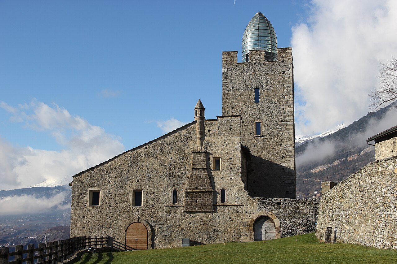
Leuk Castle (Bishop's Castle) is a castle in the municipality of Leuk in the Canton of Valais, Switzerland, built in the 13th century above the road from the Rhone valley over the Gemmi Pass. It stands about 60 metres west of the 12th-century Viztum Tower, which once guarded the route. The local noble Leuk family built a small fort that became the foundation of the current castle; they later donated their lands to the Bishop of Sion and held Leuk as a fief. The Bishop expanded the building into a larger castle that served as a residence and administrative centre. The main tower is square with sides of about 9 metres, surrounded by an irregular ring wall, with two rectangular residential buildings—the tower likely dates to the 12th century, the residential wings to the early to mid 13th century.
In 1415 the castle and the town hall were destroyed by fire. Under Bishop Supersaxo the tower was restored in 1475 and the castle was converted into the bishops' summer residence. In April 1507 the peace treaty between Valais and Savoy was signed here by the Bishop of Sion (later Cardinal Matthäus Schiner) and the Duke of Savoy, and the Valais district council held regular meetings in the castle. The 17th century saw darker episodes: the trial of Anton Stockalper and witch trials left their mark. The municipality has owned the castle since 1934; it is a listed building. Star architect Mario Botta led a restoration that turned the castle into a place for art, culture, and education—an interface between past and future. Romanesque round-arched windows survive, including one on the south side with small columns; the eastern wing has a large fireplace with a chimney projecting from the outer wall, and to the west courtyard walls with battlements and loopholes protect the entrance.
Leuk lies in the Rhone valley in Valais. The castle exterior is freely accessible; the interior is open for visits in season (e.g. July–August Mon–Fri 11:30–17:00, September Mon–Fri 11:30–16:00, October Wed and Fri 14:00–16:00; admission about 5 CHF for adults, children under 16 free; closed from November to end of June, with opening on request). Check leuk.swiss and schlossleuk.ch for current opening hours and events. Whether you come for the medieval architecture, the peace treaty and bishop's history, or Mario Botta's restoration and the cultural programme, Leuk Castle is a hidden gem that rewards every traveler who stops in Valais.
Belvédère Hotel, Furka Pass
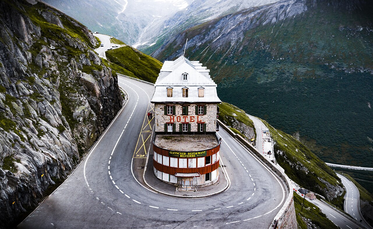
The Belvédère Hotel is a former hotel on the Furka Pass, near the Rhône Glacier, in the canton of Valais, Switzerland. The Furka Pass road was opened between 1866 and 1867, linking the Valais valley to the Uri side; in 1882 Josef Seiler built a lodge in a hairpin bend of the road. It was expanded in 1890 into a proper hotel—a gable roof and two extra floors gave it the shape it still has today—and in 1903 it was transformed into a Belle Époque luxury property. At its peak it had around 90 beds and was famous for panoramic views of the Rhône Glacier, which then lay only a few hundred metres from the road. The arrival of the postal bus in 1921 and of the Furka-Oberalp Railway and the Glacier Express in 1930 brought more guests; after the Second World War the car made it a classic excursion destination, and the hotel welcomed figures such as Pope John XXIII and Sean Connery.
The hotel became world-famous when it appeared in the 1964 James Bond film Goldfinger (part of the pass was used for the car chase). From the second half of the 20th century, however, traffic could cross the Alps in a day without stopping, and the Rhône Glacier retreated more than a kilometre, so the view from the terrace was no longer so dramatic. The hotel closed in 1980, was later bought by the Carlen family, restored, and reopened in 1990, but has been closed again since 2015. The building still stands in its striking position: in a sharp hairpin at about 2,300 m, opposite the Rhône Glacier ice grotto. It has been called one of the most photographed hotels in the world and features on the cover of Accidentally Wes Anderson.
The Furka Pass is 29 km long, connects Valais with Uri, reaches 2,429 m at the summit, and is toll-free. It is usually open from about June to October and closed in winter; check current conditions before setting out. The hotel itself is not open for overnight stays, but the exterior is freely visible—a classic photo stop. The Rhône Glacier ice grotto (about 100 m tunnel into the glacier; admission around 9 CHF) is nearby; from the ice grotto car park you can also walk a path above the grotto for a fine view over the glacier. Whether you come for the Goldfinger connection, the Belle Époque building in the hairpin, or the Rhône Glacier and the pass drive, the Belvédère Hotel is a hidden gem that rewards every traveler who makes the climb.
Bannalpsee
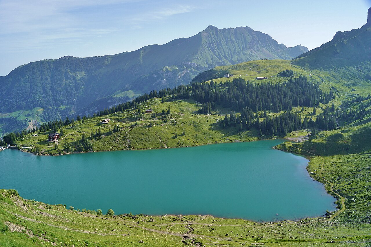
Bannalpsee is a reservoir in the municipality of Wolfenschiessen in the canton of Nidwalden, Switzerland. The lake has a surface area of 16 hectares (40 acres) and holds about 1.7 million cubic metres of water. The decision to build the reservoir was taken in 1934 and it was completed in 1937; it is operated by Elektrizitätswerk Nidwalden. Despite its role in hydroelectricity, Bannalpsee has become a beloved destination for hikers and day-trippers: the crystal-clear water reflects the surrounding peaks and meadows, and the spot remains relatively quiet even in high season. It sits at about 1,600 metres above sea level, high above the Engelberg Valley, and feels like a world away from the everyday rush.
You can reach Bannalpsee by cable car from Oberrickenbach, which is linked by post bus to Wolfenschiessen station on the Luzern–Stans–Engelberg railway. Two cable cars serve the area: the Fellboden–Bannalpsee line (red) goes directly to the lake and runs from mid-May until the end of October; the Fell–Chrüzhütte line (blue) runs year-round (with a maintenance break in November–December) and gives access to Chrüzhütte, from where a 15–20 minute walk leads down to the lake. Round-trip cable car tickets cost about 23 CHF per adult and are valid for both lines. By car, drive to the Fellboden gondola station and park there; check bannalp.ch for timetables and the webcam. You can also hike up from the valley (e.g. about 14 km, 910 m ascent, 6–7 hours)—best from mid- or late June when snow and avalanche risk have eased.
At the lake you will find Berggasthaus Bannalpsee (restaurant and accommodation), a chapel, and a playground. The 3.5 km circular trail around the lake takes about an hour and is ideal for families; at the delta where a stream flows in there are barbecue pits and firewood for picnics, and in summer cows often graze the meadows. Swimming is allowed—the water is cold but refreshing—and the Dwarf Theme Trail (Zwärgliweg) for children runs from Chrützmatte around the lake. Experienced hikers can tackle the Walenpfad, one of Switzerland's most beautiful high-altitude trails, from Bannalp to the Brunni area above Engelberg (about 10 km, 4 hours). In winter the area offers skiing and snowshoeing. Whether you come for the mirror-like reflections, the easy cable-car access, or a peaceful picnic by the water, Bannalpsee is a hidden gem that rewards every traveler who makes the trip.
These ten hidden gems of Switzerland—the Grossmünster in Zurich, Lake Brienz, the Brienzer Rothorn, Brienz/Brinzauls in Graubünden, the Aare Gorge near Meiringen, Gelmersee in the Grimsel region, Val Russein near Disentis, Leuk Castle in Valais, the Belvédère Hotel on the Furka Pass, and Bannalpsee in Nidwalden—prove that Switzerland holds more than banking and chocolate. From Reformation history and turquoise lakes to steam railways, Romansh villages, a limestone gorge, high-altitude reservoirs, a quiet Graubünden valley, a Bishop's Castle, an iconic Bond-era hotel, and a peaceful alpine lake with cable-car access, add them to your list and discover sides of Switzerland that many travelers overlook.
Spirit of Traveling Team
Passionate traveler and content creator sharing authentic travel experiences and practical tips for independent explorers.